
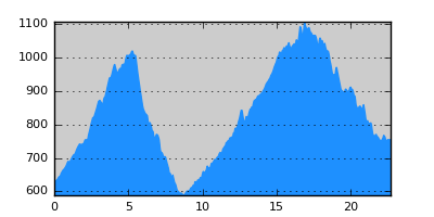
- Distance: 22.7 km
- Duration:
- Elevation Profile: show
Overview
The route avoids the short direct road between the villages. To do so one has to walk over two saddles accumulating an altitude gain of more than 800m. Nevertheless the route contains a few very beautifull sections, such as the ascend to Kikla forestry huts along Lagorema stream and has been recently cleared and signposted.
Description
You will encounter the first sign on the west of the village. The first section of the route follows the gravel (destroyed tarmac) track up the mountain, past a chapel with water. After this unattractive 4km walk, just after a telco tower turn sharp left on a track and soon right (marked) on a barely visible logging path along a meadow. Once at the treeline, you should encounter a sign pointing to the left and traces of the path descending now into the forest. At this point the path is overgrown but still comfortably passable. Later it becomes more clear but also steeper, always along a small ridge, still requiring some care since the signposting is sparse. Eventually it becomes more gentle and joins an old forest road, slowly becoming reclaimed by the forest, that zig-zags down the mountain through pines. At the end of this track you will join the asphalt road to Vathitopos and you have to turn right along it for 100m. Then turn left along a path (signed) walking between two fields to join a track just before the large stream coming from Vathitopos.
Cross it (shoes off, difficult early in the season) and continue along the track among potato and bean fields. At a sign bear left along a grassy forest track to come to Lagorema stream. Cross it and continue along the track that gradually fades out giving its place to a logging path. After passing the stream three more times you have to leave this path (that crosses the stream once more) and bear right along an obscure path. The path is narrow and a bit overgrown at places while the signposting remains sparse. If you lose it just continue along the stream (at your left hand) and you will certainly emerge on it again later. The route is wild and lonely with plenty of evidence for wild boar activity. Eventually emerge on a track out of the forest. Turn right along the track to climb on the obvious ridge ahead and then either follow the ridge with nice views of Orvilos mountain or continue on the track uphill to reach Kikla forestry huts. It is a nice place with water ideal for camping or having a break.
The rest of the route is along the forest road that traverses the slopes of the densely wooded hills (beech forest) to a saddle and then downhill to the outskirts of Perithori village. There are a couple of unmarked junctions which should not confuse you. You eventually join a paved track coming from the village by the ruins of a WWII military camp. Either turn left along the beautiful valley among old terraces towards the village or straight on to Kato Vrontou.
Amenities
There are no amenities apart from a few tavernas and grocery store.
Transportation
Bus to Nevrokopi (summer only, three times a week, Tel: 25210-32734, http://www.kteldramas.gr). From there daily bus to Drama.
Signposting
Generally sufficient but sparse signposting of the middle section of the route (Dasoto telco tower to Kikla). Missing at several key junctions elsewhere.