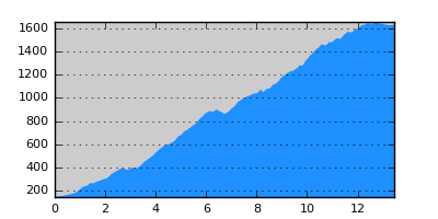
- Distance: 13.4 km
- Duration:
- Elevation Profile: show
Overview
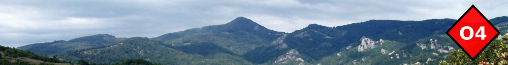
A magnificent mostly shaded hike on one of Paggaio historic trails. The trail was recently cleared and properly signposted.
Description
From the refuge follow the dirt road on the left to join the paved road to Eleftheroupoli after about 2km. Soon after, on a junction, turn steeply right on a track towards the destroyed refuge “Petaloudas”. Follow the densely marked trail downhill among pine and then beech forest steeply at places. Then the trail becomes more gentle and you will cross two streams before joining a wide dirt road. Follow it to the right for 20m and then turn left on the wide path that descents with switch-backs to the beautiful “Gourounorema” ravine and its permanent stream.
After crossing the stream, the path traverses the slope gently uphill to gain a ridge and then it follows it downhill with switchbacks and nice occasional views. Cross the dirt road a couple of times and continue in chestnut forest and shrub afterwards until the abandoned village of Palia Avli. The last part of this section is steep and eroded.
From Palia Avli follow the track to the left in front of the fountain to join the path again, that eventually descents to a gully. Continue along the stream crossing it three times over small foot bridges to finally descent towards Avli. Continue on the paved road to join the old national road to Eleftheroupoli.
Amenities
There are a few tavernas in Avli but for more move on to Eleftheroupoli.
Signposting
Very good. O4 signs and red ribbons.
Transportation
Frequent service to Eleftheroupoli and from there to Kavala and Thessaloniki.