
- Distance: 21.4 km
- Duration:
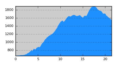
- Elevation Profile: show
Overview
This route is demanding since there is more than 1300m altitude gain. Nevertheless it is a very beautiful hike through forests with large sections on paths.
Description
Follow Megalou Alexandrou Avenue and then cross the river to continue on Gkotsi and Ioanninon street to reach the western edge of the town. There is an old E4 sign pointing towards a minor paved road on the left. A few meters ahead on Ioanninon street there is an old fountain where you may fill up with water.
Past a house the road becomes a wide forest track ascending gently. After another fountain and leisure area veer left on an unmarked but good trail to gain a large turn of the road, reaching Agios Georgios chapel. Continue on the main track and by a gully veer right steeply at first on a narrow and slightly overgrown path (E4 sign on a tree). This will emerge eventually on the road again. After a while, leave the road and veer left on a wide path (poorly signed). This crosses a clearing where for a 100m it is quite faint but look for the signs uphill and enter the forest again where it is clear finishing by the Panagia chapel.
Cross the road towards another fountain (the last one) and head straight on the wide and eroded footpath on the edge of the forest. Soon the path gets into the forest again becoming eventually a forestry track and finally emerging on the main road on a triple junction. Follow the middle branch climbing smoothly and after about 1.5km emerge at a saddle with fine views. This is Derveni (meaning pass) where E4 and E6 split.
Now continue on a small jeep track crossing a meadow that heads for the ridge south-west. After gaining the ridge this becomes a narrow path moving on the left of the ridge with small ups and down, in and out of the forest. At places the path disappears for a few meters under tall grass and ferns but it is generally not hard to follow. There are sparse red-and-yellow signs. Eventually the path descents into a deep saddle with a beautiful meadow. On your right, by the edge of the forest there is a sign pointing to another path descending to Alona.
Continue on the ridge and now start climbing steeply to gain the rocky peak named Loutzer with fine views of Vitsi and Varnountas mountains and its remnants of the civil war. Now the path starts descending again steeply at first, more gently later on through beech forests and large clearings to join a wide road on a saddle leading to the base of the Ski center at Vigla pass.
Amenities
In Vigla there is only a restaurant but there are a few hotels, restaurants and shop in Pisoderi which is about 3km from the pass. Alternatively take a taxi or the bus to Florina.
Signposting
There is inconsistent and insufficient marking on the first leg of the route until Derveni. After that the signposting is better (red-yellow signs), but care is still needed not to lose it.
Transportation
There is a bus going from Florina to Prespes region three times a week (Monday, Wednesday and Friday). It leaves from Florina early in the morning and in the early afternoon. Do check with the bus office (+30 23850 22430) for exact schedule.
Notes
The route contains high altitude sections that maybe under snow from late October to early May.
Maps
Anavasi map "Prespa - Vitsi - Voras" (1:50000)