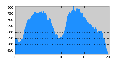
- Distance: 20.3 km
- Duration:
- Elevation Profile: show
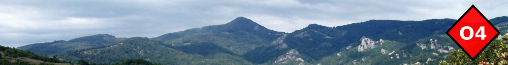
Overview
This magnificent route is mostly on footpaths under the shade of the forest. Its first section, recently discovered, crosses southern Stratoniko range to Neohori. The second section is the traverse of Kakavos mountains to Megali Panagia and was recently waymarked.
Description
From Varvara square follow the main road towards Arnea. After passing the large bridge at the bottom of the village turn right on a good dirt road. Just before a right turn of this road, turn left on the footpath that crosses a dry stream and starts ascending through dense forest. Continue past the remains of an old pen on a good path ascending gently on the left of a deep gully. Eventually reach a saddle where you join the dirt road again.
Turn left on this road following the ridge of the mountain. After about 2km turn right on a smaller track that after passing from the highest point of this section ends on a junction and saddle. Turn right and walk for another 600m on the dirt road. Turn left now on the path (the junction is not very distinct) and start descending towards a ravine. After crossing the stream continue uphill still on the footpath to join a track that ends after 100m on a saddle with nice views. Turn left on a footpath descending on the other side of the saddle. You will eventually join a rough track which you should follow to the right through a farm and gate to join another track. Turn left here and walk downhill under you emerge on the main road coming from Ierissos at the outskirts of Neohori village.
Cross the village towards its southern edge. It is difficult to find the path without a GPS but once you are on it, it is adequately waymarked. Ascend along a small stream through oak forest to end up on a saddle with a couple of old huts. There is a track coming here from the other side of the saddle. Ignore this and walk straight on to continue on the path waymarked with plastic ribbons. Continue to ascend gently and pleasantly through magnificent forest traversing the slope of Kamila peak. After passing by its highest point the path bends to the right and starts descending eventually joining a small forest track. Follow this to the right, with denser waymarking now since the remaining section is part of the annual mountain marathon. Turn left on a broad track to join the huge road leading to the gold mines at Skouries. The construction of the gold mine poses a significant natural threat and is thus fiercely opposed by the local communities. Cross this and find the continuation of the path now along a beautiful forested valley. After crossing another track and a small saddle the path becomes a rough track and descends through a patch of pine forest to join a large dirt road. Turn left on the road and right on a small steep path, passing by the 1000 year old chapel of Panagouda with nice glimpses of Megali Panagia village. A paved path will bring you to the village central square.
Amenities
There is a hostel and several tavernas. Also shops and pharmacy.
Signposting
Partly way-marked with paint-splashes and ribbons.
Transportation
There is a relatively frequent daily bus service to Arnea (Tel: 23720 22278), from where you can take the bus to Thessaloniki (www.ktel-chalkidikis.gr).