
- Distance: 28.9 km
- Duration:
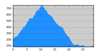
- Elevation Profile: show
Overview
A pleasant and shaded traverse of Krousia range at the border of Kerkini national park.
Description
From Miriofito square take the road east and on a junction take the left branch over a bridge to get out of the village. Continue on a track and on a junction take the right branch (E6 sign on a rock on the side of the road). Ascent gently mostly through forest all the way to the main ridge coming to a junction by a tin hut. Turn left and continue along the ridge coming to another junction. Turn steeply left ascending again in dense forest to a saddle at about 750m altitude. Ignore a road descending on your left and continue along the ridge all the way to the outskirts of Theodorio village finishing by the cemetery. Turn right and cross a small bridge to join the tarmac. Turn left and walk the remaining 6km to Rodopoli along a beautiful valley with distant views of Poroia and Radomir peak on Mpeles mountains.
Amenities
Rodopoli is the largest village in Kerkini national park and offers lodging, dining, pharmacy, doctor, post-office and shops. The area around the lake is magnificent and certainly worth exploring.
Transportation
Rodopoli has a bus connection with Sidirokastro and Serres on weekdays (23230-22221). It is also served by the Thessaloniki - Alexandroupoli railway (www.ose.gr).
Signposting
The route is signposted but at a couple of key junctions signs are missing or are misleading.