
- Distance: 34.7 km
- Duration:
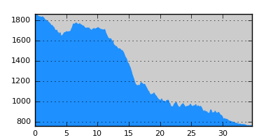
- Elevation Profile: show
Overview
Very beautifull section following the old transhuman route from the high pastures of Voras down to the planes. It is a demanding hike recently complicated by the construction of the hydroelectric dam above Skopos that adds an additional 5km to the route.
Description
From Tourkolivado continue on the paved road towards Agios Athanasios village descending through pine forests along the beautiful valley of the Floros stream. After about 3km turn right on a dirt track, cross the stream and continue along a tributary. Where the track seems to end turn right to find its continuation now reclaimed by the forest but still open. You will soon reach an old military outpost. Find the small path on its upper side that traverses a meadow and gets into the forest slowly descending towards a gully. Cross the stream and continue on a broad well trodden path to a saddle with beautiful views of Piperitsa peak.
Continue on a small track among pastures descending gently. After 1.5km the track will start making several switchbacks towards the ravine on your south. Just before that veer right on the footpath traversing smooth grassy slopes. This path is nowadays in disuse and thus covered in places with tall grass (a GPS would be essential to follow it). A difficult point is where the path crosses a stream through a patch of pines, where the path is buried under tall fern. Then. traverse gently the grassy slopes and pass by several springs approaching the beautiful and secluded Geles valley where the path becomes clear again. After crossing a stream the footpath ascends gently to reach a saddle by a stone-build pen. Now descent steeply towards the ruins of shepherds huts and a few lonely trees. Then the path disappears for about 200m, so follow the contour of the slope without losing much altitude until it becomes clear again. Eventually join a dirt road by an abandoned sheepfold and water trough.
Continue on the road that soon starts to make switchbacks. Take the footpath before each left turn that cuts back the distance. 100m after the third turn veer right on a small path descending along a broad ridge and thin bushes. Then the path cross the oak forest to reach a set of ruined huts. Turn steeply right and follow one of the faint cow trails towards the ravine ahead. Once you enter the forest the path becomes clear and after crossing the stream it climbs up again on its other side to reach a hut by a distinctive rock overhang.
Take the track to the left to join after 1.5km a forest road. Follow this to the right and pass by the old military outpost at Papadia and Agios Nikolaos chapel. Eventually as you approach the artificial lake the road becomes paved and follows its contour until the dam. It then descents with a large switchback to its base and becomes dirt again. Walk on the left bank of Geropotamos river (or what has remained of it) and after crossing to its right bank and passing by the new Agios Nikolaos chapel (nice camping location with water) reach Skopos village.
Amenities
There is no accommodation in Skopos. Camp outside the village in the yard of Agios Nikolaos chapel. Tourkolivado is not a good campsite. You have to camp on Damaskinies saddle where there is water and the forest to protect you from the wind. There are also two Sarakatsani huts there that you could possible use as a shelter.
Signposting
There is not signposting except from a few signs inside Skopos village. There are also some route finding difficulties and thus a GPS is strongly recommended.
Transportation
Skopos may accessed by Taxi from Florina. Tourkolivado is on the paved road to Kaimaktsalan ski center and thus hitch-hiking is possible although difficult during summer months.
Notes
The route contains high altitude sections that maybe under snow from late October to early May.
Maps
Anavasi map "Prespa - Vitsi - Voras" (1:50000)