
- Distance: 28.4 km
- Duration:
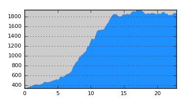
- Elevation Profile: show
Overview
A beautiful ascent on mount Kaimaktsalan through beech forest followed by a magnificent traverse of alpine pastures.
Description
The "official" route should be the dirt road starting from the first left bend of the newly constructed road from Orma to the ski center. It is along Aspropotamos valley finishing at Damaskinies saddle. After the saddle follow the paved road or an unmarked trail to Tourkolivado. A much better alternative is described here.
About 1km on the paved road from Orma to Loutraki, turn left on a wide dirt road ascending gently along the north bank of Aspropotamos river. After about 5km the road crosses a stream and there is a large pipe bringing water to the small power plant of Orma. Leave the road here and take the signed path on the right side of the stream. The path ascents through dense beech forest with switchbacks to gain the main ridge. Follow the ridge path to emerge on a saddle at Dokari where you will join a track.
Take a branch of the track ascending west with switchbacks to a shepherd hut and pen. Alternatively follow an ill defined and unmarked path also leading to the hut. Once there look for the footpath by a nearby spring. Cross several springs, streams, shepherd hut ruins and interesting rock formations to finally reach Tourkolivado after about 3 hours from the pen.
Amenities
Tourkolivado is not a good camping spot. So either camp on the trail by one of the deserted huts or head on to Skopos and camp in Floros valley.
Signposting
There is sufficient signposting (not E6).
Transportation
The only option is to get a ride on one of the passing tracks (not very frequent).
Notes
The route contains high altitude sections that maybe under snow from late October to early May.
Maps
Anavasi map "Prespa - Vitsi - Voras" (1:50000)