
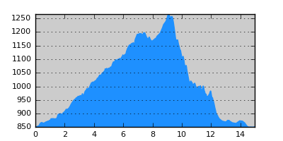
- Distance: 15.0 km
- Duration:
- Elevation Profile: show
Overview
A magnificent section along a secluded ravine to the ruins of Sfika village. Then over a saddle through forest down to Prespa lake.
Description
Coming from Gavros-Kastoria you turn west along the road going to the Albanian border and Kristalopigi. After about 1km from the junction and after crossing a bridge turn right on a track north (E6 sign) along a beautiful broad valley. After about 3km the valley becomes narrow and the track deteriorates to eventually fade out by the stream. Continue along the stream bed, through dense forest. During the summer and autumn the stream dries up but earlier there is some water flowing. There are also a few fallen trees along the way but generally the going is easy. Pass a clearing where a forest track ends and continue along the stream to eventually join a track before a pen (another E6 sign), with magnificent views of Triklario peak. There is a trough here with potable water. Turn right now along the track to eventually emerge from the forest to the beautiful valley where once Sfika village was located. The village was abandoned after the civil war and now only a few walls stand.
On a junction turn left climbing a bit more steeply now past a shrine into the forest. Alternatively take the old footpath that walks parallel to the track. Both end up on a saddle. The official routing of the trail is along the forest road descending left. I propose instead to follow the old footpath which although in disuse it remains still open and much shorter than the road. So, go straight on the other side of the saddle along a broad path. Coming to a gully the path has become overgrown for 50m but then it is clear again. Eventually it makes a sharp right turn and becomes less obvious so care is needed. After a few switchbacks you come to a clearing (views to the small Prespa lake) where you have to descend along a steep sandy ridge, but after 100m turn steeply left into the forest again. Continue on the broad path to join a track. Walk to the left for 10m and then turn right on the footpath again (now more clear) to finally join a small track. The path continues on the other side of the track but instead turn left along the grassy track ascending very gently. After about 600m you join the track you left on the saddle. Stay right, on the track, for another 800m and then turn right on the footpath again. This junction is difficult to spot. Join the road again and continue along it to come soon to Oxia village and then follow the paved road to Mikrolimni.
Amenities
There is only a taverna in Mikrolimni. Otherwise the place is ideal for camping. If you need accomodation move on to Lemos and Agios Germanos.
Signposting
There are only a few signs on the first part of the route. Also some plastic ribbons.
Transportation
Mikrolimni is served by a bus to Florina and Agio Germanos, three times a week (Monday, Wednesday and Friday). It leaves from Florina early in the morning and in the early afternoon. Do check with the bus office (+30 23850 22430) for exact schedule
Notes
To continue to Agios Germanos, you may ask from a fisherman to take you to Agio Achilios islet for a fee. There are byzantine monuments here worth seeing. Then walk over the footbridge to the mainland and continue along the road to Agios Germanos. During the fish breeding season (April 15 to May 15) boats are not allowed and you have alternatively to follow the road around the lake.
Maps
Anavasi map "Prespa - Vitsi - Voras" (1:50000)