
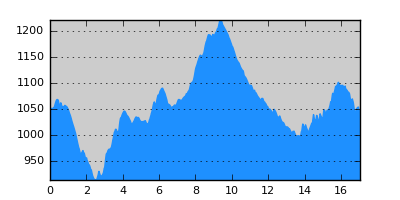
- Distance: 17.0 km
- Duration:
- Elevation Profile: show
Overview
This is an easy and magnificent hike on the century old transmigration route.
Description
Take the dirt road south of the village and on a junction veer left downhill towards the river to reach the magnificent stone bridge of Zouzouli set among the imposing wooded cliffs on the opposite side. Cross the bridge and continue along the river bank upstream. During summer months there is little water and crossing the stream is straightforward. After about 200m you reach the tip of a ridge and turn steeply left uphill along this ridge soon to find the footpath that climbs into the forest. After 5 minutes you reach a narrow section of the ridge where the original path has collapsed and it is dangerous to follow. Instead climb straight ahead steeply to reach easier ground just a few meters above. Very soon the path becomes wide and clear and now continues traversing the slopes gently uphill. After another short intimidating traverse where the path has been washed out and is now one boot wide you reach the ruins of Agios Athanasios chapel. Superb views of Smolikas and Vasilitsa mountains. From here one the path continues with small ups and downs, it is wide and mostly shaded and generally easy to follow. I have some evidence that this is a part of the old “road” from the plane of Thessaly to the mountain pastures of northern Pindus. Eventually, out of the forest, you reach a large clearing where the path fades out and after a dry water trough you join the paved road from Eptahori just beyond the shepherd's huts at Ntetsou once an important road station. There is water 200m ahead on the main road to Dotsiko.
On the opposite side take the forest road past the huts and into the pine forest initially gently uphill and then downhill along the beautiful secluded valley forming Paliomagero stream. After about 5km and after crossing the stream join a wider track and follow it uphill to end up on the ridge just above Dotsiko village. Alternatively if you want to continue to Pentalofos, Dilofo or Dasilio, stay in the valley following the forest road.
Amenities
There are a couple of hostels and a few tavernas in Dotsiko.
Signposting
There is no signposting.
Transportation
None.
Notes
This is my proposed diversion of the trail to deal with a blocked section over Taliaros mountain. The original routing of E6 towards Pentalofos was a west-east crossing of Taliaros mountain. I have surveyed the path down to Zouzouliotiko stream and up to the chapel of Ag. Nikolaos (in disuse but still walkable and sparsely signed). From here one I found the goat path climbing to Taliaros (also found a single sign on a tree), unfortunately blocked. I have also found signs along Kapsala valley and then climbing from Bania area to Panoukla peek (steep and hard to find footpath) and then to Pentalofos. In the past all roads passed Taliaros (looking like a natural wall from the west) either from the north (now the national road) or the south, therefore I believe that the proposed diversion is quite logical geographically. Although the route is extended by one segment it has the advantage of being easy but also quite interesting and Dostsiko offers the necessary amenities for a stop point. I have also found some sparse evidence that the proposed route was part of the century old route to northern Pindos which adds to its appeal.
Maps
Anavasi map "Gramos, Smolikas, Voio, Vasilitsa" (1:50000)