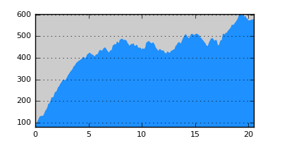
- Distance: 20.5 km
- Duration:
- Elevation Profile: show
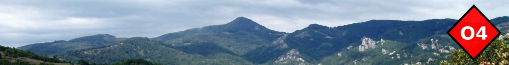
Overview
The route initially crosses Vathorema ravine and then continues along the main ridge of Seih-Sou hills overlooking the town. Overall it is an easy, well shaded, but long hike, along well maintained trails.
Description
Turn left by the holocaust monument and continue on a wide track. Once you encounter a large pen turn right and start descending on a footpath towards the ravine ahead. Once by the stream turn steeply left and cross it after a few meters. Soon the path makes a wide left bend in an open area with remains of pen nearby. Leave the main path here (continuing to Thermi) and take the track a few meters above. Continue on tracks uphill o join the road Panorama - Hortiatis. Follow it to the left for 200m and then turn right on a footpath through forest. Continue alternating between tracks and footpaths to the highest point of the route, the water reservoir above Asvestohori. Continue on well trodden footpaths passing by Artemis and Kranos hills offering superb views of the city. Soon leave the main ridge, passing by a couple of huts and continue along a gully towards the ring road, which you cross below one of its bridges. Continue on laid paths and tracks afterwards to conclude the hike beside the power station on the north of Kavkatzoglio stadium.
Signposting
The are irrelevant signs that you must ignore. Rely on a GPS to avoid getting lost in the extensive trail network.
Transportation
From/To Hortiatis take the local bus No. 58 and then No. 61.
Notes
Water is not available along the route.