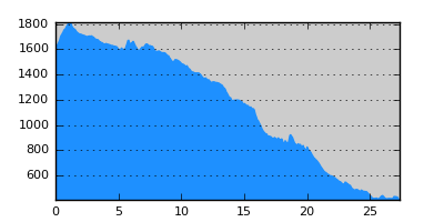
- Distance: 27.4 km
- Duration:
- Elevation Profile: show
Overview
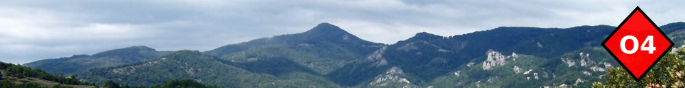
A long traverse of the south-west slopes of Paggaio down to the deserted village of Mesolakia. This is an alternative to the route towards Rodolivos to avoid the long and boring segment from Rodolivos to Amfipoli. From Mesolakia is about 10km to Amfipoli.
Description
The first part of the route is the same as the segment going to Rodolivos After joining the forest track coming from Rodolivos refuge (water trough on the right). Continue on this track downhill for 400m and then turn left along a path towards a saddle on the ridge on your left. Descend on the other side of the ridge to join a track by the ruins of a pen. Follow the track downhill for about 800m to the beginning of the forest and then leave the track and look for the footpath a few meters below (plastic ribbons). Then continue along this path through the forest. It is in disuse but easy to follow. Emerge on a saddle out of the forest. Descend along a faint path on the left side of the valley ahead at the edge of the forest on loose ground. Continue through the forest along a gully by a small stream, eventually joinining a forestry track. Continue along this track ignoring all right junctions, up to a saddle and hunters hut, and start descending to another valley. Continue monotonously along the west side of the valley. After abother saddle and water through emerge at the ruins of Mesolakia setlement.
Amenities
Mesolakia village was abonded in the sixtees and its inhabitants descended to Nea Mesolakia by the Strimonas valley. Some houses have been rebuild since but there are no amenities here. So you may still find some people in the summer.
Signposting
Partly way-marked with plastic ribbons.
Transportation
None.