
- Distance: 13.4 km
- Duration:
- Elevation Profile: show
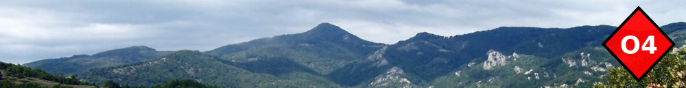
Overview
A magnificent mostly shaded hike on one of Paggaio historic trails. The trail was recently cleared and properly signposted.
Description
Follow the main paved road to the north of Avli to find the first sign and the footpath. The footpath climbs gently and shaded along a stream crossing it three times over small foot bridges. Later it becomes unshaded and a bit steep but soon reaches the abandoned village of Palia Avli. Continue through shrub initially on a steep and eroded footpath and then through a chestnut forest now gently uphill crossing a forest track several times. Eventually the path enters the beech forest climbing to a saddle with nice views. From there descend gently to the beautiful “Gourounorema” ravine and its permanent stream. Continue uphill with switchbacks to join a track and 20m to the right find the footpath again ascending gently. After crossing two small streams the trail becomes steeper and a bit fuzzy but densely signposted. Emerge before the destroyed refuge "Pataloudas" to join a forest track and the main road coming from Eleftheroupoli soon after. Follow it for a few meters and then after a fountain turn right on a track. After about 2km the track emerges on the beautifull Orfeus valley and the mountain refuge.
Amenities
The mountain refuge is normally locked, but if you are a large group you may negotiate that someone opens them for you (Hatzigeorgiou refuge: SXO Kavalas, 697 877 0560). Alternatively there is a covered porch that may host about five people. Note that there is no drinking water close by.
Signposting
Very good. O4 signs and red ribbons.