
- Distance: 21.8 km
- Duration:
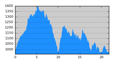
- Elevation Profile: show
Overview
A beautiful traverse of the eastern flanks of the thickly forested Aoos valley. It is not an easy hike since the path crosses two deep ravines before descending to Vovousa. Parts of the trail have become overgrown adding to orientation difficulties despite the good signposting. Yet the route is still fairly walkable and certainly worth it. A section of the trail has become blocked so I have re-routed it via a forestry track.
Description
From the square on the northern edge of Distrato follow the dirt road south-east climbing gently towards the obvious ridge visible on the south. After about 2.5km by a spring ignore the signed trail towards a saddle on the ridge, since its continuation is now blocked. Instead continue on the road eventually turning on the south side of the ridge. This points offers magnificent views of Aoos gorge with splendid vistas of Smolikas and Timfi range. After about 1km turn right on a forestry track (unsigned) traversing the steep slope, through fir forest. There is some undergrowth that increases as we go further downhill. After about 1.5km the road makes a sharp right turn and subsequently a sharp left turn. Exactly at the edge of this turn climb down to the right and you should find a sign after a few meters.
The footpath here is very fuzzy and practically dissapears along forest clearings, yet the signposting is generally adequate as soon as you stay alert. Eventually you reach a stream and cross to the other side where the trail becomes more distinct but still problematic. Passing by the ruins of a building the footpath and signposting disappear. Take care not to follow what looks like a grassy track to the left but instead continue downhill along the stream until you join the path again, now clear. After crossing the stream a couple of times the path descends to the main stream.
Cross the stream and continue gently uphill. From here on the trail is in a better condition, yet becoming overgrown at places. Soon you traverse a rocky spur with breathtaking near vertical drops and views of the seer rock faces of Stathis ravine. Signs of brown bear activity are evident in the area. Continue through mixed beech and fir forest with several switchbacks to negotiate the 300 vertical meters from the bottom of the valley to a road uphill. Once on the road turn right and continue along it for about 5km, pleasantly and with good views of Aoos valley and the thickly wooded slopes. Pass a characteristic saddle and clearing (Paliomonastiro area) where the road turns east and after about 300m turn right down a signed forestry track. Ignore signs pointing to the left (blocked path) and continue on the track with a fair of undergrowth. Just after the track turns steeply left, turn right along a very indistinct but well signed trail to join the stream. Continue on a good path through beech forest that joins the road again. Turn right and walk for another 2.5km now with Aoos river close by on your right hand side. The road emerges on the paved road coming from Perivoli and terminating in Vovousa after 1km.
Amenities
Vovousa has a few hostels and tavernas. There is also a mountain refuge that is open year around 2km from Vovousa on the road to Ioannina.
Signposting
There is sufficient signposting along the route (E6 signs, red-yellow squares, red disks and yellow blazes). Still care is needed at places.
Transportation
None. Take a taxi to Ioannina or hitchhike.
Maps
Anavasi map "Valia Kalda - Vasilitsa" (1:50000)
Though the route is depicted incorrectly.