
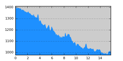
- Distance: 15.7 km
- Duration:
- Elevation Profile: show
Overview
The route descends gently along the wild ravine formed between Avgo and Flega mountains. It is a relatively easy and well maintained hike and one of the best in northern Pindos through a unique and pristine landscape.
Description
Follow the track parallel to Arkoudorema stream. Where the track fades out continue on the footpath crossing the river over a bridge. At a junction immediately after keep right (left goes to Flega peak and its alpine lakes). Continue along the stream crossing it three more times. Then the path traverses the steep southern slopes of Avgo mountain until the point where Arkoudorema joins Aoos river. There is a junction here going left across the river if you want to go to the refuge. Otherwise continue straight on parallel to Aoos traversing several streams and scree slopes (some care needed). Eventually joint a track and follow it to join the paved road coming from Ioannina. Turn right along the road to finish the hike in Vovousa village.
Amenities
Vovousa has a few hostels and tavernas. There is also a mountain refuge that is open year around 2km from Vovousa on the road to Ioannina.
Signposting
There is sufficient signposting along the route.
Transportation
None. Take a taxi to Ioannina or hitchhike.
Notes
Some river crossings may be tricky early in the season or after heavy rain.
Maps
Anavasi map "Valia Kalda - Vasilitsa" (1:50000)