
- Distance: 14.1 km
- Duration:
- Elevation Profile: show
Overview
A beautiful hike along a historic trail.
Description
The route follows the old covered water supply pipe used for hydration of Kavala during the Turkish occupation. It then continues downhill towards the settlement of Palia Kavala. The path was recently waymarked while information boards with various historical notes have been placed along the first half of the route.
Starting from Kavala old aqueduct follow Dimokratias Str. and then 13th September Str. At the end of this road continue on a paved track, passing by a few farm houses, eventually becoming a broad path. Pass a couple of stone bridges and join a dirt road that leads below the huge valley bridge of Egnatia motorway. Rejoin the path again now downhill towards a gully. Cross it over an impressive stone bridge and continue along the stone paved water pipe that ascents gently along a well shaded ravine. Finally cross the stream and climb on steps to the spring “Mana Nerou” (mother of water).
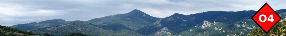
Follow a well laid path through sparse vegetation to join a road. Turn right and follow it to a saddle with kiosk and amazing views of Thassos island. Behind the kiosk continue on a broad path, now downhill, with occasional views of majestic Paggaio mountain and the plane of Philipi. As the path approaches the valley ahead it becomes more steep but still comfortable. Eventually you come by a stream which you cross over a wooden bridge. Continue on the path on the other side and ascend to Palia Kavala village.
Amenities
There are only a couple of tavernas. You have to take the bus or taxi to Kavala for accommodation.
Signposting
Very good.
Transportation
You either have to call a taxi or walk to Zigos village where there is a bus service (except from Sundays) to Kavala.